Archaeology & Disputed Artefacts
Yonaguni: Monumental Geometry in Layered Sandstone
The Yonaguni formation is a genuine underwater landform. Claims of extensive human construction exceed the archaeological evidence, while limited modification of a natural outcrop remains possible.
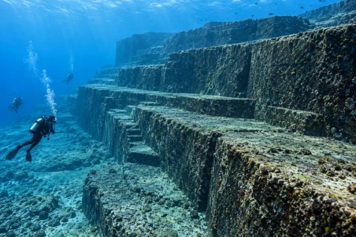
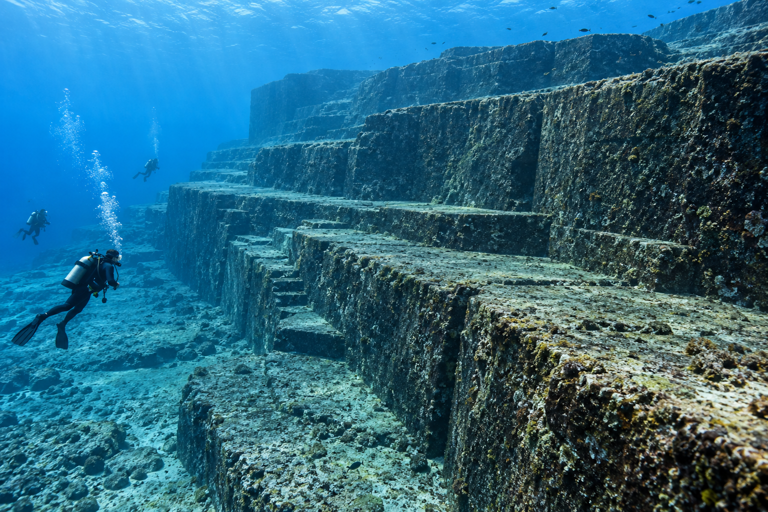
Off the southern coast of Yonaguni Island, divers encounter a sandstone mass rising in broad terraces and sharp-edged steps. Since the 1980s it has been promoted as a submerged monument, pyramid or remnant of a civilisation old enough to predate the sea-level rise after the last ice age.
The geometry is real, but straight edges are not uniquely human. The Yaeyama rocks contain strong horizontal bedding and near-vertical joints. Waves, currents, earthquakes, gravity and abrasion exploit these weaknesses, detaching blocks and leaving platforms. Comparable angular outcrops occur along Yonaguni’s coast above water.
Marine geologist Masaaki Kimura has argued for artificial features and possible modification. Other geologists see a predominantly natural landform and note the absence of diagnostic masonry, quarry debris, tools, securely cultural deposits or inscriptions. A natural outcrop could still have been visited or locally altered without becoming a built city.
The strongest photographs often isolate the most regular terrace and use divers for scale. A complete interpretation must also include fractures, collapsed blocks and irregular slopes outside the frame. Survey selection can make geology appear more planned without altering the rock itself.
Yonaguni belongs with the archive’s guide to out-of-place artefacts, the demonstrated human landscape of the Nazca Lines, and the context problem of the Kensington Runestone.
Claim, Context and Cautions
Why the formation looks built
Repeated horizontal benches, apparent stairs, channels and isolated blocks create powerful architectural cues. Underwater visibility and camera angle can emphasise selected alignments while hiding broken or irregular areas. Names such as road, gate or stadium then encourage observers to see a planned complex.
Visual resemblance is a starting observation. Construction requires marks, transported material and spatial relationships that natural fracture and erosion do not explain.
The island’s geology
Yonaguni lies in an active tectonic region. Sandstone and mudstone beds are cut by systematic joints, providing flat and perpendicular surfaces before erosion begins. Coastal platforms above sea level demonstrate that the same rock breaks into rectilinear forms without builders.
Earthquakes and storm energy can remove large blocks. Rounded weathering is not required in a setting where fresh joint faces are repeatedly exposed.
Claims of human modification
Kimura’s work interprets selected holes, arrangements and shapes as evidence of a cultural site and connects exposure to lower prehistoric sea levels. Dating the rock or time of submergence does not date a carved surface. Proposed animal figures and inscriptions are especially dependent on outline selection.
Evidence of a hearth, worked stone, tool mark pattern or associated settlement would be more diagnostic. Published surveys have not established such an assemblage.
Natural does not mean unimportant
A natural formation can be archaeologically used, symbolically important and scientifically valuable. People may have walked portions when sea level was lower, and limited steps or cuts are not impossible. Those narrower possibilities should not be inflated into proof of a lost high civilisation.
The best-supported interpretation is jointed sandstone shaped by erosion, with any human alteration unproven. Mapping complete surfaces, comparing terrestrial outcrops and documenting marks at close scale are more useful than deciding from dramatic photographs alone. A cultural claim should predict evidence that a new survey can find, rather than redefining every natural break as design.
Reference trail
Sources
- Electronic Journal of Geography, Geosites of Yonaguni Island (opens in a new tab)Peer-reviewed field study of island landforms, geological setting and comparable outcrops.
- Nagoya University repository, research on the age of the Yonaguni submarine formation (opens in a new tab)University repository record for Kimura’s artificial-monument interpretation and survey claims.
- Research Society for the Geology of Japan, paleogeography and submarine ruins (opens in a new tab)Published geological argument for artificial features, included as the principal competing interpretation rather than established fact.
Case Book
Photographs, Maps and Supporting Images
Supporting images provide documentary, geographic or visual context. Read each caption for its date, source and evidential limits.

Continue researching
Follow the evidence, context and comparisons
Curated connections
Selected editorially for this entry.
Why disputed objects need context, chain of custody and patient interpretation before becoming extraordinary evidence.
Curated connection · Case fileThe Nazca Lines: Huge Drawings Without Impossible BuildersThe Nazca Lines are extraordinary landscape works, but careful archaeology explains them through human labour, ritual geography and desert preservation.
Curated connection · Case fileThe Kensington Runestone: A Viking Claim in a Minnesota FieldThe Kensington Runestone is a real carved object with disputed origins. Its language, runes and discovery context favour a nineteenth-century creation, while the identity and precise motive of its maker remain unresolved.
More through shared context
Additional routes based only on existing topics, themes and metadata.
Scientifically examined crystal skulls do not support claims of ancient or paranormal origin. Tool marks, quartz provenance and sales records place prominent examples in the modern era.
Same primary topic · Shared theme: Disputed artefacts · Case fileNan Madol: Engineering a Ceremonial City on the ReefNan Madol remains archaeologically challenging, but its builders and broad chronology are not unknowable. Local oral histories, settlement evidence and scientific dating converge on Pohnpeian construction and Saudeleur power.